Formation of Potential Tropical Cyclone 8
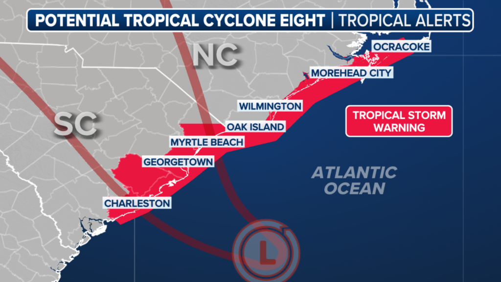
The National Hurricane Center has announced that the system previously known as Invest 95L is now designated as Potential Tropical Cyclone 8. This change allows for the issuance of a Tropical Storm Warning for the coastal regions of North Carolina and South Carolina.
Forecast and Impact
Expected to strengthen into Tropical Storm Helene early this week, Potential Tropical Cyclone 8 is predicted to bring gusty winds, heavy rainfall, and coastal flooding to parts of the Carolinas on Monday. A Tropical Storm Warning is currently in effect from Edisto Beach, South Carolina, to Ocracoke Inlet, North Carolina.
Current Location and Warnings
As of now, Potential Tropical Cyclone 8 is located approximately 95 miles from Charleston, South Carolina. The NHC has highlighted dangerous conditions along the Southeast coast, advising residents to prepare for potential flooding and rough seas.
Rainfall and Flooding Risks
Forecast models indicate widespread rainfall totals of 4-8 inches, with isolated areas receiving up to 10 inches in northeast South Carolina and southeast North Carolina on Monday. The remainder of North Carolina could see 2-4 inches, while Virginia may experience 1-3 inches of rain through Wednesday, raising concerns about flash flooding.
Coastal Hazards
The development of this potential tropical cyclone increases the risk of rip currents and beach erosion, particularly along North Carolina’s Outer Banks and southeastern Virginia. Past storms, such as Hurricane Ernesto, have caused significant damage, including the collapse of homes into the ocean due to severe erosion.
Safety Advisories
Local authorities have issued advisories for beachgoers and boaters, warning them to exercise caution due to the anticipated rough surf conditions. While the current system is being monitored closely, officials have yet to determine the full impact it may have compared to previous storms.

